Imaging Spectroscopy and LiDAR
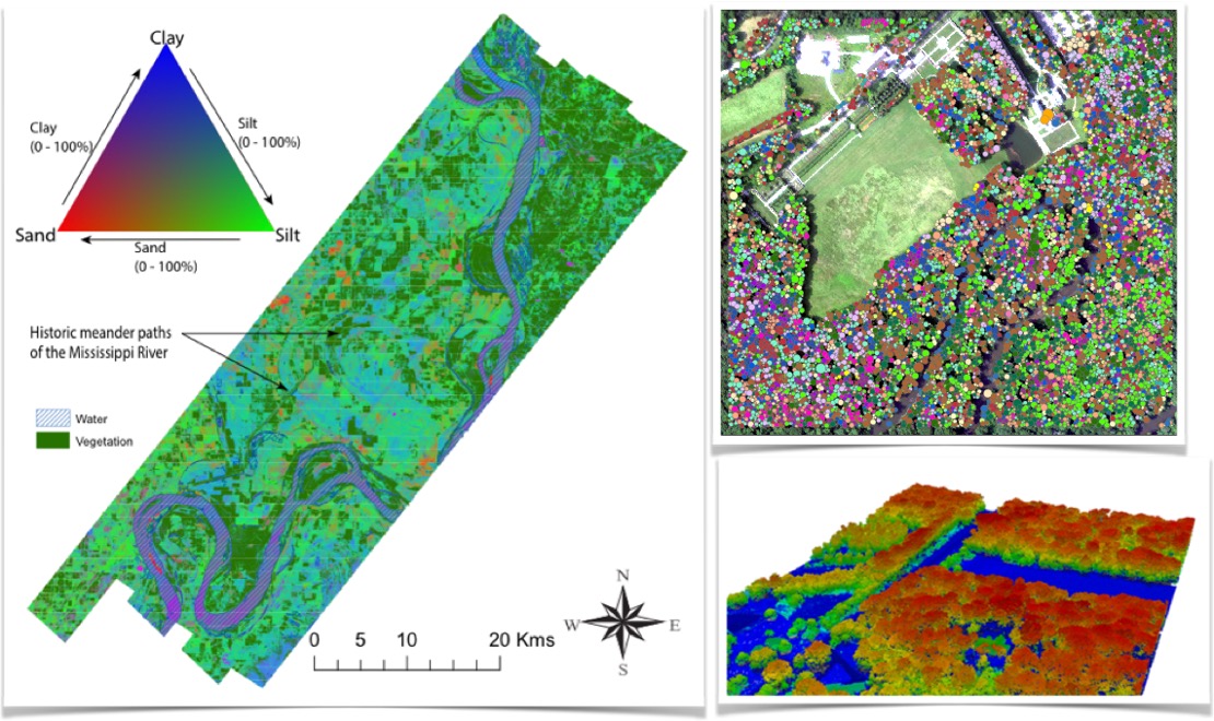
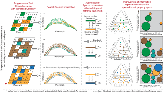
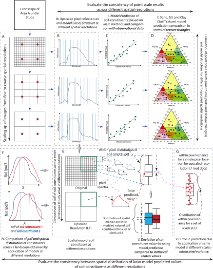
Soil textural attributes (sand, silt, and clay fractions) play a critical role in hydrological modeling, while soil organic matter and nutrient composition are key indicators of soil health and plant productivity. Our research demonstrates that airborne imaging spectroscopy with high signal-to-noise ratios enables the quantification of these soil properties at very high spatial resolutions. Furthermore, we show that statistical learning frameworks can effectively estimate various soil constituents with limited ground samples, offering potential applications for spaceborne hyperspectral observations.
Additionally, vegetation canopy structure is fundamental for determining the vertical distribution of radiative states and scalar fluxes, which regulate photosynthesis and transpiration. Active optical remote sensing, particularly point cloud LiDAR, is valuable for estimating vertical foliage distribution. However, low point cloud density presents challenges in characterizing dense, overlapping forest canopies. To address this, we propose a feature-based fusion of imaging spectroscopy and LiDAR, which offers improved characterization under such conditions.
Related Publications